The Giétro Disaster: How a volcano in Indonesia triggered a flood in Switzerland


On April 10, 1815, a mountain on the island of Sumbawa exploded. Mount Tambora, a fourteen thousand foot (3400 meter) peak at the Indonesian island’s north end, had begun stirring three years earlier, rumbling and spitting out clouds of ash. Somewhere below, pressure began to build, and on that day in April the mountain finally gave way. The eruption blasted the upper mile of the edifice into the sky, its 150 cubic kilometers of rock ripped into a plume of hot shards. Roiling clouds of incandescent dust poured down the mountainsides at the speed of a bullet train, killing at least 71,000 people, including all or most speakers of one of the island’s three unique language families.
The 1815 Mount Tambora eruption is considered the largest in recorded history, weighing in at a Volcanic Explosivity Index of seven: the maximum value. People reported hearing the volcano’s thunder as far away as Sumatra, and possibly Thailand and Laos as well. The blast column pierced the stratosphere, where it injected a cloud of sulfur dioxide, which reacted to form sulfate aerosols. In the months that followed, wind currents rafted these tiny particles across the northern hemisphere.
Aerosols are fine dust particles suspended by air turbulence (the word aerosol means “airborne soil”). In the lowest layer of the atmosphere, where clouds and rain are common, aerosols tend to get washed out relatively quickly. But once aerosols get into the stratosphere, they can linger for several years. Eruptions like Tambora’s can load the stratosphere with sulfate aerosols, which reflect sunlight and shade the ground below. The effect of Tambora’s 1815 eruption was akin to smearing the planet with a layer of mineral sunscreen.
Halfway around the globe and half a year later, winter bit deeply and refused to let go. As the northern spring of 1816 dawned, the weather in Europe, Asia, and North America remained stubbornly chill. June arrived, but summer didn’t come with it. Cold and rain in the British Isles led to failed harvests. Across continental Europe, still reeling from the devastation of the Napoleonic Wars, and already caught up in a centuries-long period of cool known as the Little Ice Age, food prices spiked as crop yields plummeted. Riots broke out across Europe’s cities in the greatest surge of urban unrest since the French Revolution. Epidemics of typhus spread. Major rivers flooded. Mountain snowpacks were tinted rusty red with volcanic dust. The last spring frosts came late and the first autumn frosts came early, before crops could be harvested. Altogether, much of Europe endured its worst famine in a century.
In China, the missing summer triggered a famine in Yunnan, while monsoon rains flooded the fertile Yangtze Valley. In India, a late but torrential monsoon helped spread cholera.
In North America, skies were hazed and dimmed by “dry fog.” Frost and dust-darkened snow licked New York and New England through May and into June, and were back again by August. Even balmy Virginia had its crops stung by an August freeze. Food prices climbed. Annum 1816 would forever be known as The Year Without a Summer.
During that cold wet summer, a trio of British writers—Percy Bysshe Shelley, Mary Shelley, and Lord Byron—huddled indoors in Byron’s Geneva villa, amusing themselves with stories that allegedly inspired Shelley’s novel Frankenstein. Byron composed his famous poem Darkness, which tells of how
The bright sun was extinguish'd, and the stars
Did wander darkling in the eternal space,
Rayless, and pathless, and the icy earth
Swung blind and blackening in the moonless air;
Morn came and went—and came, and brought no day
While Byron and the Shelleys were swapping dark tales in Geneva, the cool wet weather fed glaciers across the Swiss Alps. Over the next two years, these glaciers swelled and advanced. Tongues of ice thickened and stretched and slipped further down their valleys.
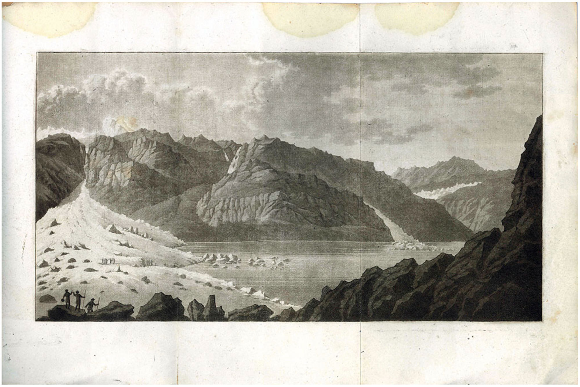
One of those icy tongues was the Giétro Glacier. High above the picturesque Val de Bagnes, Giétro occupied a bowl of land surrounded by snow-capped peaks. Today, the Giétro’s receding terminus hangs just barely over the precipice of a high rocky slope that overlooks the Val de Bagnes a thousand meters below. In the years leading up to 1818, the Giétro’s nose oozed downward well beyond this ledge and onto the steep ramp below, its frozen and fractured mass clinging precariously to the rocky wall.i
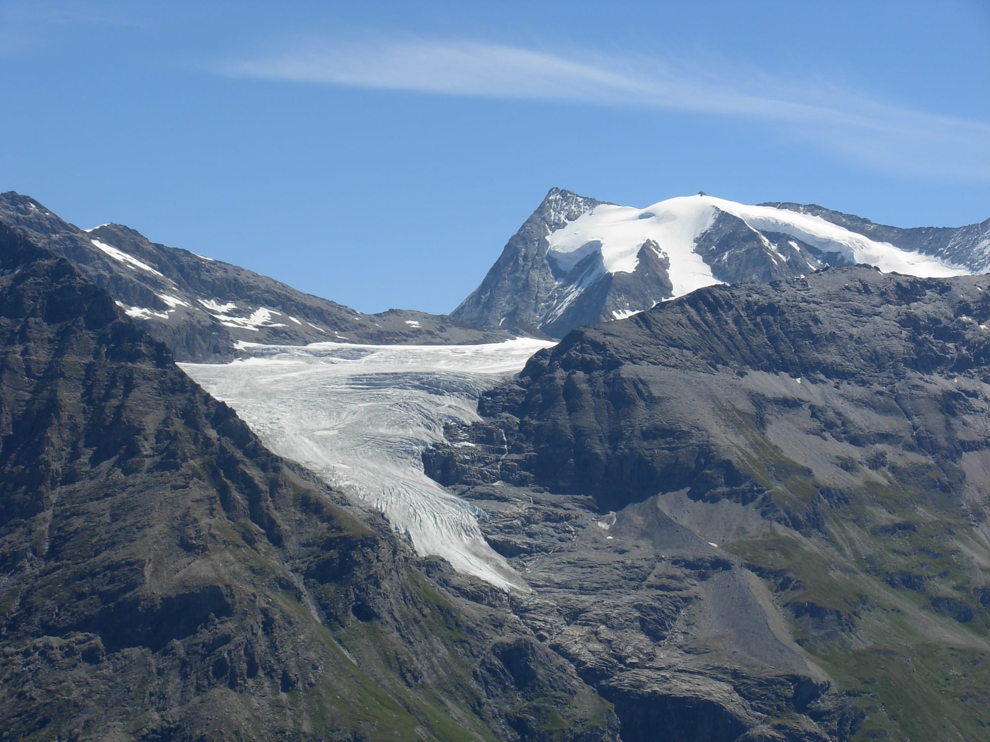
In the chill summer of 1816, the glacier began to drop chunks of ice down into the valley below, building up a cone of fragments. A lake formed, then quietly drained. Then in the spring of 1818, a series of large ice avalanches tumbled into the valley, where they piled up against the opposite wall to a height of some 90 meters—nearly the length of a football field tilted vertically.ii
Several miles down the valley, the River Drance’s spring gush slowed to a trickle. Locals alerted the authorities, who dispatched a team led by Ignaz Venetz, the cantonal engineer.iii Venetz soon discovered the cause: an ice dam some 600 meters wide was blocking the Drance, creating a lake that was rapidly filling. Venetz understood the danger. This was not the first time an ice-dam had formed in the upper Val de Bagnes. In the years 1549, 1590, and again in 1680, similar dams had formed and then burst. The 1590 event, for example, had unleashed a flood that killed 140 people and destroyed hundreds of buildings.
After setting up a system of fire signals to warn downstream villages in case the dam should give way, on May 11 Venetz and his men began carving a tunnel through the ice in hopes of draining off excess water before the entire edifice of ice fragments gave way under pressure from the steadily rising lake.
By the 4th of June, the team had excavated a 195-meter tunnel through the ice dam. The tunnel was just shy of two meters high and a bit more than a meter wide: big enough, presumably, for a person to haul out barrows filled with shattered ice and rock debris. Then Venetz and his team retreated to high ground to watch as the lake continued to fill.
On June 13, the rising water reached the level of the tunnel. Soon the entrance became clogged with ice blocks; a worker named Jacob Aberlin managed to unblock it, getting swept up in the current in the process but miraculously emerging unharmed.
The swift, turbulent flow in the ice tunnel generated frictional heat. The walls and floor began to melt, widening and deepening the tunnel. By the early hours of June 15, the flow had melted clear through the lower end of the ice dam and reached a deposit of rocky debris beneath it. The stream then began carving a channel in these sediments. As of 6:00 a.m. that day, witnesses reported the incision as having reached about 25 meters deep.
The next day, 16 June 1818, at 4:30 in the afternoon, the whole edifice gave way. An analysis by Christophe Ancey and colleagues (see note i), based on eyewitness accounts, suggests that the eroded sedimentary pile under the ice dam probably collapsed, taking most of the dam with it. What remained abruptly failed. The dam break unleashed a thirty meter deep surge of water, ice, mud, rocks, and shattered trees, as the lake spilled its contents into the valley below.
Within about thirty minutes, the flood wave reached the village of Champsec, bearing a thirteen-meter-high flood crest. An hour later, a diminished but still powerful wave hit Martigny with a two to three meter high wall of water and debris. Around 7:00 pm, the flood swept through Saint-Maurice. Four hours later, the flow finally emptied into Lake Geneva, some 40 miles downstream and 1400 meters below the original ice dam.
Despite precautions and warnings, approximately 44 people perished in the 1818 Giétro Débâcle (the exact number is uncertain; some of those missing may have been travelers or foreign workers who left the area under their own power rather than the flood’s). The surge also wiped out 17 bridges and destroyed several hundred buildings.iv
Events like the Giétro disaster serve as reminders that we live in a connected world. Neither the air above us nor the waters around us—frozen or otherwise—recognize any borders.
i This account is based in part on Ancey, C., Bardou, E., Funk, M., Huss, M., Werder, M. A., & Trewhela, T. (2019). Hydraulic reconstruction of the 1818 Giétro glacial lake outburst flood. Water Resources Research, 55(11), 8840-8863.
ii For a timeline, see Zryd, A. (2008). Les glaciers en mouvement: la population des Alpes face au changement climatique (Vol. 47). Collection Savoir Suisse.
iii Ignaz Venetz would later become famous as one of the originators of the theory of ice ages, alongside Jean de Charpentier, Louis Agassiz, and Karl Schimper. He probably developed his ideas through conversations with Jean-Pierre Perraudin, a mountain guide and naturalist who lived in the Val de Bagnes and was involved in the Giétro response. The fact that the Giétro flood did not produce bedrock striations or transport erratic boulders may have helped convince Venetz that only glaciation could explain these features. The history of ice age theory is nicely told in Tobias Krüger’s 2013 book Discovering the Ice Ages: International Reception and Consequences for a Historical Understanding of Climate.
iv Glacial outburst floods like the 1818 Giétro disaster aren’t limited to times of volcanically induced cold. In an eerie echo of that day, on the 28th of May 2025 an avalanche of ice and rock from the Birch Glacier buried most of the village of Blatten in southwest Switzerland. The avalanche debris blocked the river Lonza, triggering flooding (fortunately, in this case the river seems to have cut its own spillway, preventing a catastrophic rupture). Thanks to a combination of geophysical monitoring and emergency preparedness, only one person was killed in the Blatten Landslide, though many homes were lost.

